
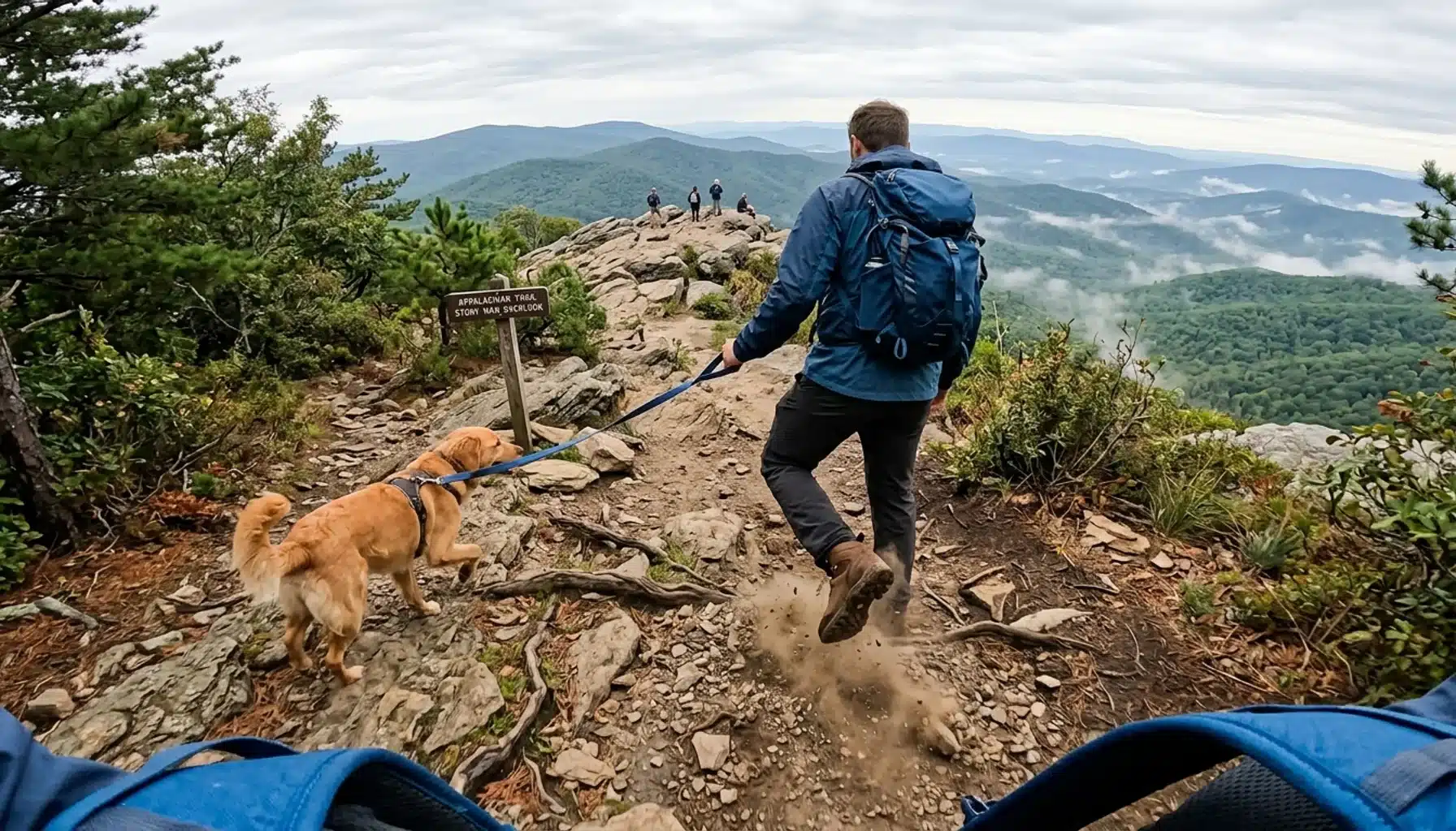
Virginia hiking trails split cleanly into three effort tiers: easy leg-stretchers under 1.5 miles with under 300 feet of elevation gain, moderate loops between 1.5 and 4 miles with rolling climbs, and strenuous routes exceeding 5 miles or gaining more than 1,500 feet. Matching your trail to your actual fitness level, not your ambition, is the single biggest factor in whether a Virginia hike ends in satisfaction or a miserable limp back to the car.
- Shenandoah National Park maintains more than 500 miles of hiking trails, and dogs are permitted on 480 of those miles, according to Delaware North Parks and Resorts at Shenandoah, the park’s official concessionaire.
- The Blue Ridge Parkway corridor south of Shenandoah adds dozens more trails organized by milepost, ranging from the 0.5-mile Roanoke River Trail to the 10.8-mile Rock Castle Gorge Trail.
- Easy trails like Blackrock Summit and Elk Run Trail near Peaks of Otter run under a mile with minimal elevation change, ideal for casual couples or a first morning hike.
- Strenuous bucket-list hikes such as the Great Channels (6.6 miles) and Apple Orchard Falls Trail (1.2 miles, but rated strenuous for its steep grade) demand real cardio conditioning and sturdy footwear.
- Shenandoah Valley’s short-term rental market recorded a median occupancy rate around 44 percent in 2026, according to AirROI, meaning cabins near the trailheads book up during peak fall foliage weekends.
- Front Royal and Linden, Virginia sit roughly 40 minutes from Skyline Drive’s northern entrance, making the area a practical base camp for testing multiple difficulty levels across a single weekend.
Virginia hiking trails get lumped together constantly in generic “bucket list” roundups that mix a 0.5-mile boardwalk with a 10-mile ridge scramble under the same “must-do” banner. That’s not helpful. It’s how people end up twisting an ankle on a trail rated for experienced trekkers when they meant to book a gentle Sunday walk.
At Royal Oak Retreat, we hear this constantly from guests staying at our wellness cabin in Shenandoah Farms, near Front Royal: they want to hike, but they don’t know which trail matches their actual conditioning versus their Instagram feed’s conditioning. This guide sorts Virginia’s best hikes, both inside Shenandoah National Park and along the Blue Ridge Parkway further south, by real effort level: distance, elevation gain, and terrain type, not just difficulty labels that mean different things depending on who wrote them.
You’ll get specific mileage, drive times, and honest caveats for each trail, plus guidance on how to string together an easy morning hike and a challenging afternoon summit in the same trip. In 2026, with Shenandoah Valley’s trail network drawing steady year-round demand, matching your trail to your fitness level matters more than ever for actually enjoying the hike instead of surviving it.
What Counts as an Easy Virginia Hiking Trail?
An easy Virginia hiking trail is generally under 1.5 miles round trip with less than 300 feet of elevation gain, flat or gently graded terrain, and no scrambling required. These trails work for casual couples, first-time hikers, or anyone wanting a short forest walk before dinner rather than a cardio event.
Blackrock Summit, located at milepost 84.4 in Shenandoah National Park, is a 1-mile round trip hike gaining about 175 feet, according to the National Park Service. The payoff is a rock outcrop with a 360-degree view, reached without any technical scrambling. It’s one of the best short hikes in the park for guests who want a summit view without summit effort.
Further south along the Blue Ridge Parkway, Elk Run Trail at milepost 85.9 near Peaks of Otter Lodge runs under a mile and is rated easy, as is the adjacent Abbott Lake Trail, a 1-mile loop circling Abbott Lake near the visitor center. Both are flat, well-maintained, and family-of-adults friendly. Mountain Industry Trail at Mabry Mill (milepost 176) is also under 0.5 miles and easy, doubling as a quick history stop near the historic mill.
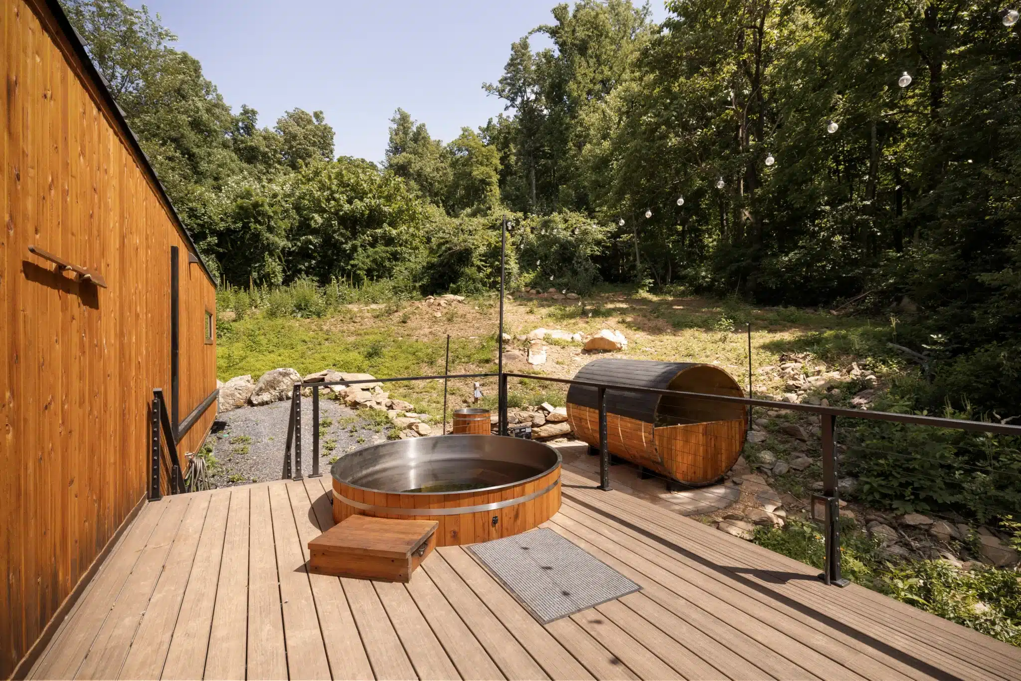
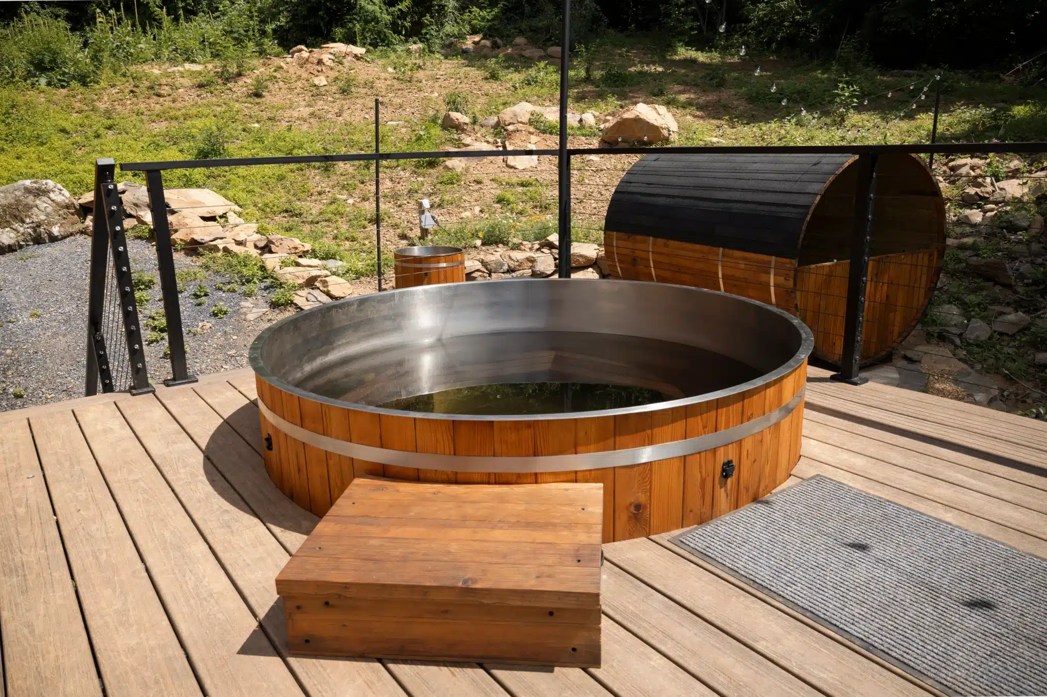
For guests staying at Royal Oak Retreat, Shenandoah National Park sits about 40 minutes away, close enough to knock out an easy morning trail before returning to soak in the sunken hot tub by early afternoon. Skip Dark Hollow Falls on a Saturday afternoon in October if you want to avoid crowds. It’s short, at 1.4 miles round trip, but its waterfall payoff makes it one of the most heavily trafficked easy trails in the park, according to the National Park Service.
Which Moderate Trails Work Best for Couples and Small Groups?
Moderate Virginia hiking trails typically run 1.5 to 4.5 miles with rolling or sustained climbs, generally between 300 and 800 feet of elevation gain, and terrain that stays on marked, maintained paths without requiring hands-on scrambling. These are the sweet spot for couples who hike occasionally and want a real workout without technical risk.
Johnson Farm Loop Trail, starting from the Abbott Lake Trailhead at Peaks of Otter, covers about 1.75 miles and is rated moderate, winding past a restored 19th-century farmstead. Fallingwater Cascades Trail at milepost 83.1 runs 1.6 miles with a moderate rating and drops hikers alongside a multi-tiered waterfall, one of the more photogenic moderate hikes on the parkway. Flat Top Trail, also near Peaks of Otter at milepost 83.5, extends to 4.4 miles and stays moderate throughout, making it a solid half-day option for couples who want mileage without a strenuous grade.
Otter Creek Trail, between the James River Visitor Center and Otter Creek Campground (mileposts 60 to 63.8), covers 3.5 miles at a moderate rating, tracing the creek downstream toward the James River. Black Ridge Trail from Rocky Knob Visitors Center at milepost 169 runs 3.1 miles, also moderate, through mixed hardwood forest with occasional ridge views.
If you’re planning a romantic afternoon, pair a moderate hike with a stop at Fox Meadow Winery in Linden, roughly 5 minutes from Royal Oak Retreat, or Crimson Lane Vineyards in Hume, about 8 minutes away. Both make an easy add-on after a 2 to 3 mile trail, since neither requires much recovery time before you’re comfortable sitting down for a tasting. Our Romance Package pairs naturally with this kind of low-key, hike-then-unwind day.
What Are the Bucket List Strenuous Hikes in Virginia?
Strenuous Virginia hiking trails generally exceed 5 miles, gain more than 1,000 feet, or involve steep, sustained grades and occasional rock scrambling, and they demand real cardiovascular conditioning and proper footwear. These are the hikes worth building a full day around, not squeezing in before dinner.
The Great Channels, in Russell County, is a 6.6-mile round trip hike via the Brumley Mountain Trail leading to a network of narrow sandstone crevices you can walk through, a genuinely unusual rock formation for Virginia. Rock Castle Gorge Trail at milepost 167.1 on the Blue Ridge Parkway is the longest strenuous option in this guide at 10.8 miles, looping through a deep gorge with significant elevation change throughout.
Sharp Top Trail, climbing from the Peaks of Otter camp store to the summit, is only 1.5 miles one way but earns its strenuous rating from a steep, sustained grade the entire distance. Spec Mines Trail at milepost 96, a U.S. Forest Service route, covers 2.8 miles and is also rated strenuous. Apple Orchard Falls Trail at milepost 78.4 is short on paper, 1.2 miles, but the descent to the falls and subsequent climb back out earns it a strenuous rating that surprises hikers expecting an easy waterfall walk.
Crabtree Falls, between mileposts 339.5 and 340.2, offers two options: a 1.8-mile round trip to the base of the 60-foot falls, or a 2.5 to 3-mile loop for those who want the full waterfall system. The shorter option is moderate; the full loop tips into strenuous territory with its elevation gain.
How Difficult Is the Appalachian Trail in Virginia?
The Appalachian Trail runs through Virginia for a longer stretch than any other state, and within Shenandoah National Park it roughly parallels Skyline Drive for about 100 miles. Difficulty within the park varies section by section: some stretches near overlooks stay relatively gentle, while sections near summits like Hawksbill or Stony Man involve real elevation gain and rocky footing. Day hikers typically pick a short access point rather than attempting a multi-day thru-hike segment, and several of the moderate and strenuous trails in this guide, including sections near Peaks of Otter, connect directly to the Appalachian Trail corridor.
Where Is the Devil’s Bathtub in Virginia?
The Devil’s Bathtub is a rock formation with a striking blue-green pool located in Scott County, in far southwest Virginia, well outside the Shenandoah Valley and Blue Ridge Parkway corridor covered in most of this guide. The hike to reach it involves multiple stream crossings and is known for being significantly harder and wetter than its official mileage suggests, which is why it draws frequent warnings from hikers about slick rocks and unpredictable water levels. If you’re basing a trip out of Front Royal or the northern Shenandoah Valley, the Devil’s Bathtub is a multi-hour drive away and not a realistic day-trip pairing with the trails discussed above; it’s better treated as a separate southwest Virginia trip.
Virginia Hiking Trails Compared by Distance and Difficulty
| Trail | Location | Distance (round trip) | Difficulty |
|---|---|---|---|
| Blackrock Summit | Shenandoah NP, milepost 84.4 area | 1 mile | Easy |
| Elk Run Trail | Peaks of Otter, milepost 85.9 | Under 1 mile | Easy |
| Abbott Lake Trail | Peaks of Otter Lodge | 1 mile | Easy |
| Mountain Industry Trail | Mabry Mill, milepost 176 | Under 0.5 miles | Easy |
| Johnson Farm Loop | Peaks of Otter | 1.75 miles | Moderate |
| Fallingwater Cascades | Milepost 83.1 | 1.6 miles | Moderate |
| Otter Creek Trail | James River area, mileposts 60-63.8 | 3.5 miles | Moderate |
| Black Ridge Trail | Rocky Knob, milepost 169 | 3.1 miles | Moderate |
| Flat Top Trail | Peaks of Otter, milepost 83.5 | 4.4 miles | Moderate |
| Apple Orchard Falls | Milepost 78.4 | 1.2 miles | Strenuous |
| Sharp Top Trail | Peaks of Otter | 1.5 miles one way | Strenuous |
| Spec Mines Trail | Milepost 96 | 2.8 miles | Strenuous |
| Great Channels | Russell County | 6.6 miles | Strenuous |
| Rock Castle Gorge | Milepost 167.1 | 10.8 miles | Strenuous |
What Is the Most Beautiful Mountain Area in Virginia?
Most seasoned hikers and Virginia tourism sources point to the Shenandoah National Park and Blue Ridge Parkway corridor as the state’s most scenic mountain region, largely because Skyline Drive and the parkway string together dozens of overlooks with layered ridgeline views that are hard to match elsewhere in the state. The Peaks of Otter area, with Sharp Top and Flat Top rising above Abbott Lake, is frequently singled out as a standout stretch within that broader corridor.
What sets this region apart isn’t a single peak but the density of access points. Within roughly an hour of Front Royal, you can reach dozens of trailheads ranging from a 0.5-mile boardwalk to a 10-mile gorge loop, all within the same Blue Ridge geological system. Franklin Cliffs Overlook, a stop along Skyline Drive, gives a sense of the layered ridge views without requiring any hike at all, useful for a scenic drive day between trail days.
What Is the Prettiest Place in Virginia?
Skyline Drive through Shenandoah National Park is commonly cited as one of Virginia’s prettiest drives and destinations, especially during peak fall foliage in mid-to-late October, when the 105-mile road winds through ridges lit up in red, orange, and gold. The National Park Service notes the park spans more than 500 miles of hiking trails, giving visitors a genuinely wide range of ways to experience that scenery beyond just driving through it.
Fall foliage weekends are also the most crowded, with Skyline Drive overlooks filling up and parking at popular trailheads like Old Rag becoming difficult by mid-morning. If pretty-but-quiet is what you’re after, a weekday visit in late September or early November, just before or after peak color, delivers similar scenery with a fraction of the traffic.
How Do You Pick the Right Trail for Your Trip?
Choosing the right Virginia hiking trail comes down to matching three factors honestly: your recent hiking frequency, your available daylight, and whether you’re hiking solo, as a couple, or with a mixed-ability group. Start with the shortest trail rated for your fitness level, not the longest one you think you can survive.
Match Your Trail to Your Recent Activity Level
If you haven’t hiked more than twice in the past six months, start with an easy trail under 1.5 miles, such as Blackrock Summit or Abbott Lake Trail. Save moderate and strenuous trails for day two or three of your trip, once your legs have adjusted to uneven terrain again.
Check Daylight and Weather Before You Commit
Strenuous hikes like Rock Castle Gorge at 10.8 miles need a full daylight window, ideally starting by 9am. Afternoon thunderstorms are common in the Blue Ridge during summer months, so plan strenuous hikes for morning starts and save easy trails for late afternoon when storms are more likely.
Common Mistakes to Avoid
- Underestimating “short but strenuous” trails. Apple Orchard Falls is only 1.2 miles but its steep grade catches people who assume short equals easy.
- Skipping water on moderate trails. A 3.5-mile trail like Otter Creek still takes 90 minutes to 2 hours; bring at least one liter per person.
- Ignoring parking limits at popular trailheads. Small lots at trailheads like Dark Hollow Falls fill by mid-morning on fall weekends; arrive before 9am or plan an alternate trail.
- Forgetting a 4×4 vehicle in winter. Some access roads to trailheads and cabin driveways in the Shenandoah Valley, including the road to Royal Oak Retreat, require four-wheel drive after snow.
Is Hiking in Virginia Safe for Everyone?
Virginia hiking trails are generally safe for healthy adults of most fitness levels when matched correctly to difficulty rating, but a few conditions deserve extra caution before you head out.
Heart Conditions and Cardiovascular Fitness: Strenuous trails like Rock Castle Gorge or the Great Channels involve sustained climbing that raises heart rate significantly. If you have a diagnosed heart condition or haven’t exercised regularly in months, talk to your doctor before attempting anything rated strenuous, and start with easy or moderate trails instead.
Summer Heat and Hydration: Virginia summers bring high humidity, and even moderate trails can lead to dehydration or heat exhaustion by midday. Carry at least one liter of water per person for moderate trails and two liters for strenuous ones, and consider starting before 8am in July and August.
Slippery or Uneven Terrain: Waterfall trails such as Fallingwater Cascades or Dark Hollow Falls have wet rock near the base that gets slick, especially after rain. Wear shoes with real tread, not sandals or worn sneakers, and take extra time on descents.
Lightning and Afternoon Storms: Summer afternoons in the Blue Ridge frequently bring thunderstorms. If you’re on an exposed summit like Sharp Top or Blackrock and hear thunder, descend immediately rather than waiting it out.
Pets on the Trail: Dogs are allowed on 480 of the 500-plus miles of trails in Shenandoah National Park, according to Delaware North, but they need to stay leashed and hydrated too. Check trail-specific pet rules before bringing a dog on longer or steeper routes.
How Does Staying Near Front Royal Change Your Hiking Plans?
Basing your trip in Front Royal or the surrounding Shenandoah Farms area puts you within 40 minutes of Shenandoah National Park’s northern entrance, giving you same-day access to both easy trails inside the park and the option to drive further south along the Blue Ridge Parkway for the Peaks of Otter cluster of trails.
This matters because a lot of Virginia hiking guides assume you’re already staying inside the park or hours south near Roanoke. Front Royal sits at the northern gateway, meaning you get shorter drive times to Skyline Drive’s early mileposts and easier access back to Washington D.C., roughly an hour away, if you need to combine a hiking weekend with other DMV-area commitments.
After a strenuous morning hike, the contrast-therapy setup at Royal Oak Retreat, a sauna and cold plunge built as a dedicated wellness island alongside the sunken hot tub, gives sore legs somewhere real to recover. Guests regularly tell us the combination of heat and cold after a long trail day works better than they expected for next-day soreness. For more on what’s within reach of the cabin, our Nearby Experiences page and our dedicated hiking trails guide for Shenandoah National Park go deeper into park-specific logistics.
What Should You Pack for a Day of Virginia Trail Hiking?
A well-packed day hike in Virginia includes water, sun protection, sturdy footwear, and layers, since Blue Ridge weather shifts quickly with elevation. For easy trails under a mile, a single water bottle and comfortable sneakers are usually enough. For moderate to strenuous trails, pack more deliberately.
- Water: One liter minimum for moderate hikes, two liters for anything over 5 miles or rated strenuous.
- Footwear: Trail runners or hiking boots with actual tread, especially for waterfall trails or anything with loose rock.
- Layers: Temperatures at higher elevations on Skyline Drive run 5 to 10 degrees cooler than the valley floor; bring a light jacket even in summer.
- Navigation: Cell service is unreliable throughout much of the park and parkway; download offline maps or carry a paper map from the visitor center before you leave.
- Snacks: Trail mix or a sandwich for anything over 2 hours; strenuous hikes like Rock Castle Gorge can take 5 to 6 hours round trip.
Frequently Asked Questions
What is the easiest hiking trail in Shenandoah National Park?
Blackrock Summit, at milepost 84.4, is one of the easiest trails in the park at 1 mile round trip with about 175 feet of elevation gain, according to the National Park Service. It reaches a rock outcrop view without any scrambling required.
How many miles of hiking trails does Shenandoah National Park have?
Shenandoah National Park has more than 500 miles of hiking trails, according to both the National Park Service and Delaware North Parks and Resorts at Shenandoah, the park’s concessionaire. Dogs are permitted on 480 of those miles.
Can I bring my dog on Virginia hiking trails near Shenandoah?
Yes. Dogs are allowed on 480 of the more than 500 miles of trails in Shenandoah National Park, per Delaware North Parks and Resorts at Shenandoah. Keep dogs leashed at all times, and check individual trail rules since a small number of trails restrict pets.
What is the best time of year to hike in the Shenandoah Valley?
Fall, particularly mid to late October, offers the most dramatic scenery along Skyline Drive but also the heaviest crowds and trailhead parking pressure. Late spring (May) and early fall (September) offer comparable scenery with noticeably lighter traffic and cooler hiking temperatures.
How difficult is the Appalachian Trail through Virginia?
Difficulty varies significantly by section. Portions running near Skyline Drive overlooks stay relatively gentle, while segments near summits like Hawksbill or Stony Man involve real elevation gain and rocky footing. Most day hikers access short sections rather than attempting long multi-day stretches.
Is Old Rag the only strenuous hike worth doing near Shenandoah?
No. Old Rag draws the most attention because of its permit system and rock scramble, but strenuous options like Rock Castle Gorge (10.8 miles) and the Great Channels (6.6 miles) further south along the Blue Ridge corridor offer comparable challenge with far fewer crowds and no permit requirement.
Do I need a 4×4 vehicle to reach trailheads or cabins in the Shenandoah Valley in winter?
Some steep or unpaved access roads in the Shenandoah Farms and Front Royal area, including the driveway at Royal Oak Retreat, require a 4×4 vehicle in winter due to snow and grade. Check road conditions before a winter trip and confirm vehicle requirements with your accommodation directly.
How long does it take to hike Rock Castle Gorge?
Rock Castle Gorge Trail, at 10.8 miles with significant elevation change, typically takes most hikers 5 to 6 hours round trip depending on pace and rest stops. Start early in the morning to avoid finishing after dark, especially in fall and winter when daylight hours shrink.
The Bottom Line on Virginia Hiking Trails
Virginia hiking trails work best when you pick based on honest effort level rather than a generic “must-see” list. An easy trail like Blackrock Summit or Abbott Lake Trail delivers a real payoff in under an hour, while strenuous routes like Rock Castle Gorge or the Great Channels demand a full day and real conditioning. As of 2026, Shenandoah National Park’s 500-plus miles of trails and the Blue Ridge Parkway’s milepost system give hikers of every level a legitimate option within the same regional corridor.
The smartest approach for a weekend trip is to mix tiers: an easy morning trail, a moderate afternoon hike the next day, and recovery time built in between. Basing that trip out of Front Royal or Shenandoah Farms keeps every trail in this guide within a reasonable drive, whether you’re heading into the park or south toward Peaks of Otter.
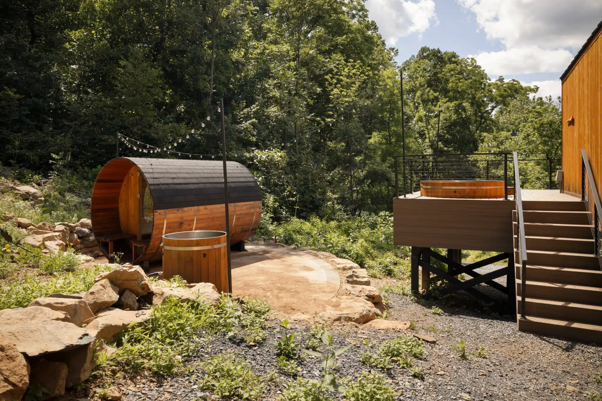
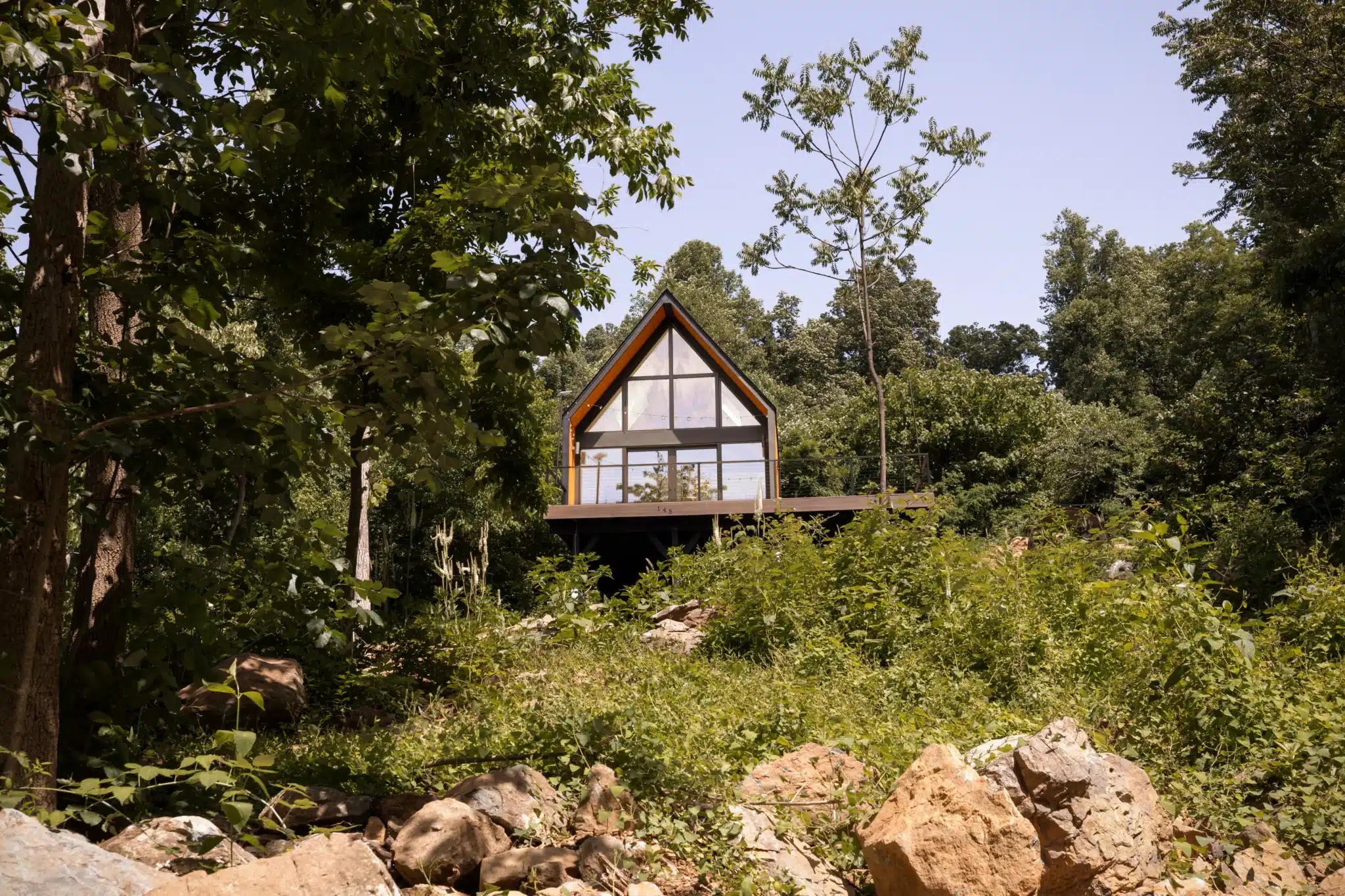
If your Virginia hiking trip includes anything rated moderate or strenuous, Royal Oak Retreat sits about 40 minutes from Shenandoah National Park with a sauna and cold plunge built specifically for days like that. Check available dates and see the full cabin at royaloakretreat.com.
Content powered by inkSTR.co