
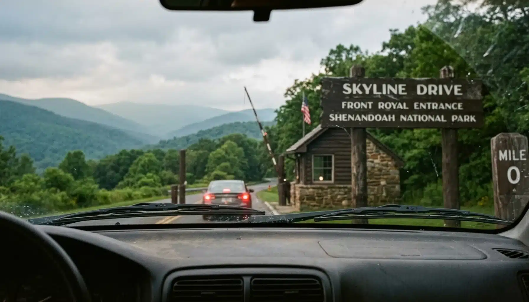
Skyline Drive starts at Front Royal, Virginia, at its junction with U.S. Route 340, and ends about 105 miles south at Rockfish Gap, just outside Waynesboro, where it connects directly to the Blue Ridge Parkway. The road runs the entire length of Shenandoah National Park along the crest of the Blue Ridge Mountains.
Key Takeaways
- Skyline Drive is a 105-mile north-to-south road, the only public road running the full length of Shenandoah National Park, according to the National Park Service.
- The northern terminus sits at Front Royal at Milepost 0, where the drive meets U.S. Route 340; the southern terminus is Rockfish Gap near Waynesboro, generally cited around Milepost 105.
- Four entrance stations exist along the route: Front Royal (mile 0), Thornton Gap (mile 31.5), Swift Run Gap (mile 65.5), and Rockfish Gap (mile 104.6), so you don’t have to start at either endpoint.
- The National Scenic Byway Foundation estimates the full 105-mile drive takes about three hours with no stops, though most travelers stretch it to a full day with overlooks and short hikes factored in.
- Front Royal is close to Interstate 66, making the northern end the natural pick for travelers coming from Washington, D.C., while Rockfish Gap connects onward to Interstate 64.
- Shenandoah National Park drew 1.7 million visitors in 2026 who spent $132 million in nearby communities, according to National Park Service data, and Skyline Drive is the spine that makes nearly all of that visitation possible.
If you’re mapping out a trip along Skyline Drive in 2026, the endpoint question is the first thing to nail down, because it determines which direction you drive, which gateway town you base out of, and how much time you actually need. This guide answers exactly where the road starts and stops, why different sources cite slightly different milepost numbers, and how to pick an entrance station that fits your route instead of forcing you to drive the whole thing end to end.
We wrote this from Front Royal, Virginia, the town that sits at the northern doorstep of the drive and the closest access point for most Washington, D.C. area travelers. At Royal Oak Retreat, a wellness cabin about 40 minutes from the Shenandoah National Park boundary, guests ask us this exact question on nearly every stay: where do I actually get on Skyline Drive, and where does it let out. Below is the practical answer, along with the entrance-station math that most articles skip.
Where Does Skyline Drive Start and End?
Skyline Drive begins in Front Royal, Virginia, at its intersection with U.S. Route 340, marked as Milepost 0, and ends 105 miles south at Rockfish Gap near Waynesboro, Virginia, where it becomes the Blue Ridge Parkway. The road runs north to south along the spine of the Blue Ridge Mountains for the entire length of Shenandoah National Park.
The National Park Service describes Skyline Drive as the only public road that traverses the park, and it is the single access corridor for nearly every overlook, trailhead, and visitor center inside Shenandoah’s boundaries. Specifically, the road was built in sections during the 1930s to open the newly established park to automobile travel, and its north-south orientation still defines how visitors plan a trip today.
Front Royal marks the north end and Rockfish Gap marks the south end, but the exact milepost number attached to each varies slightly depending on the source, which is worth clarifying before you plan a route.
Why Do Sources Disagree on the Exact Mileposts?
Mile numbers for Skyline Drive’s endpoints vary slightly across sources because some measure from the highway junction itself while others measure from the official park boundary or entrance station a short distance beyond it. Roadtrippers cites the southern end at milepost 105.4 near Waynesboro, while the National Scenic Byway Foundation rounds to milepost 105 at the park’s south end.
The discrepancy is a few tenths of a mile, not a meaningful navigation error. As a result, the numbers you see attached to Front Royal (mile 0 versus mile 0.6, for example) and Rockfish Gap (104.6, 105, or 105.4) reflect different reference points along the same short stretch of road near each gate.
For practical trip planning, ignore the decimal differences and trust the milepost signs themselves once you’re driving. A route guide covering the four entrance stations confirms these signs are posted on the west side of the road, meaning they appear on your right when heading south and on your left when heading north. Every overlook, trailhead, and visitor center inside the park is labeled by the milepost nearest it, so once you’re on Skyline Drive, the signage does the work for you regardless of which endpoint figure a website quoted.
Which Skyline Drive Entrance Is Best?
The best Skyline Drive entrance depends on where you’re driving from: Front Royal at mile 0 suits travelers coming from Washington, D.C. or Interstate 66, Thornton Gap at mile 31.5 suits those coming via Route 211 near Luray, Swift Run Gap at mile 65.5 works for Route 33 near Elkton, and Rockfish Gap at mile 104.6 suits travelers arriving on Interstate 64.
You are not required to drive Skyline Drive end to end, and most day-trippers don’t. Specifically, entering at Thornton Gap lets you skip the northernmost 31 miles if your priority is Old Rag-area trailheads or Luray Caverns, while entering at Swift Run Gap puts you closer to Big Meadows and the park’s midsection in a fraction of the drive time.
For guests staying near Front Royal, the northern gate is the natural choice because of its proximity to Interstate 66 and the short distance from the DC metro area. Lazytrips notes that this makes the north entrance especially convenient for travelers coming from Washington, D.C., Baltimore, or even Pittsburgh.
| Entrance Station | Milepost | Connecting Route | Best For |
|---|---|---|---|
| Front Royal | Mile 0 | U.S. 340 / Interstate 66 | DC metro travelers, full north-to-south drive |
| Thornton Gap | Mile 31.5 | Route 211 near Luray | Luray Caverns visitors, shorter northern loop |
| Swift Run Gap | Mile 65.5 | Route 33 near Elkton | Big Meadows area, midpoint access |
| Rockfish Gap | Mile 104.6 | Interstate 64 / U.S. 250 | Blue Ridge Parkway connection, Waynesboro/Charlottesville arrivals |
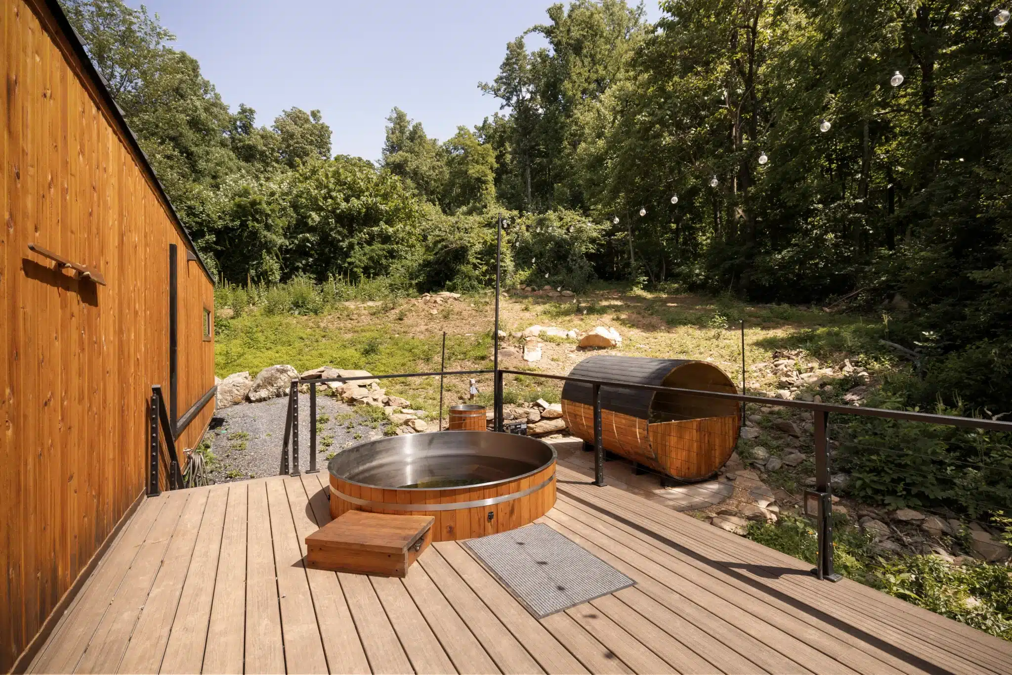
At Royal Oak Retreat, guests are roughly 40 minutes from the Shenandoah National Park boundary, which makes the Front Royal entrance station the obvious jumping-off point for a Skyline Drive day trip before returning to the cabin’s private hot tub and sauna that evening.
How Long Does It Take to Drive the Full Skyline Drive?
Driving the full 105-mile length of Skyline Drive takes about three hours without stops, according to estimates from the National Scenic Byway Foundation. In practice, most visitors take considerably longer because the speed limit throughout the park caps at 35 miles per hour, and there are 75 overlooks tempting you to pull off.
Realistically, plan for four to six hours if you want to stop at a handful of overlooks, walk a short trail like Blackrock Summit near mile 84.4, or grab lunch at one of the park’s lodges. If you’re adding a longer hike, such as Dark Hollow Falls or the Upper Hawksbill Summit, budget a full day.
Traffic moves slowly on weekends during peak fall foliage, typically the first three weeks of October, when the Shenandoah Valley sees its heaviest annual visitation. On a quiet weekday in spring or early summer, you can move through the park’s midsection more freely, though the 35 mile-per-hour cap still applies the entire way, no exceptions for clear roads.
For a weekend trip based near Front Royal, we tell guests to treat Skyline Drive as a half-day to full-day excursion rather than a quick loop. That leaves the evening open for the fire pit and sunken hot tub back at the cabin, which is exactly the kind of unhurried pace Royal Oak Retreat is built around.
How Much Does It Cost to Drive Through Skyline Drive?
Driving Skyline Drive requires paying the Shenandoah National Park entrance fee, which covers unlimited access for the vehicle for seven consecutive days regardless of how many times you enter or exit. You can purchase a Shenandoah 7-day vehicle pass online through Recreation.gov ahead of time to avoid a line at the gate.
If you plan to visit multiple national parks within a 12-month period, the America the Beautiful annual interagency pass from the USGS store covers entrance fees at Shenandoah and hundreds of other federal recreation sites nationwide. This is worth it if Shenandoah is one stop on a bigger national park itinerary for the year.
Beyond the entrance fee, the only other required cost is gas, since Skyline Drive itself has no tolls. Budget separately for food at Big Meadows Lodge or Skyland if you don’t pack a picnic, and factor in parking at trailheads, which is free but limited at popular pull-offs during peak fall weekends.
Can I Sleep in My Car on Skyline Drive?
Sleeping in your car directly along Skyline Drive’s overlooks or pull-offs is not permitted; overnight parking at scenic overlooks is prohibited under park regulations designed to keep pull-offs available for daytime viewing and to manage wildlife activity after dark. Camping and overnight stays are restricted to designated campgrounds and lodging within the park.
Inside the park, developed lodging includes Skyland at miles 41.7 and 42.5, Big Meadows Lodge at mile 51, and Lewis Mountain Cabins at mile 57.5, all operated by Delaware North under the park concession agreement. For a more rustic option, the Potomac Appalachian Trail Club maintains primitive backcountry cabins inside the park for members and guests willing to book ahead.
For most travelers, though, staying just outside the park near Front Royal offers a more comfortable base without sacrificing proximity. A cabin with a private hot tub and non-toxic build, like Royal Oak Retreat, means you get a genuine wellness reset after a long day on the drive rather than a rustic overnight parked at a pull-off. See our full breakdown of cabin rentals in Shenandoah Valley Virginia for other lodging comparisons in the region.
What Should You Know Before Planning Your Route?
Route planning for Skyline Drive means deciding your direction of travel, your entrance point, and how many stops you want to make, since the road’s 105-mile length and four entrance stations create multiple valid itineraries rather than one single correct way to drive it. Notably, most first-time visitors assume they must drive the entire route in one direction, but that’s rarely the most efficient plan.
If you’re coming from Washington, D.C. or Northern Virginia, entering at Front Royal and driving south toward Thornton Gap or Big Meadows, then exiting back onto U.S. 211 or 340, keeps your loop manageable in a single day. If you’re continuing on to Charlottesville or points south, driving the full length to Rockfish Gap and picking up Interstate 64 makes more sense, and from there the road connects seamlessly onto the Blue Ridge Parkway for travelers heading toward Asheville or beyond.
Fuel up before entering the park. There is no gas station along Skyline Drive itself, and the nearest stations are in gateway towns like Front Royal, Luray, or Waynesboro. Cell service is spotty for long stretches inside the park boundary, so download offline maps beforehand.
Common mistake: underestimating the 35 mile-per-hour limit. Drivers used to highway speeds often assume they can cover 105 miles in under two hours; between the speed cap, curves, and wildlife crossings (deer are frequent at dawn and dusk), three hours minimum without stops is realistic, and that’s before any overlook photos.
How Do Gateway Towns Fit Into a Skyline Drive Trip?
Front Royal, Luray, Elkton, and Waynesboro are the four gateway towns positioned near Skyline Drive’s entrance stations, and each offers a different mix of dining, wineries, and lodging depending on which end of the park you’re accessing. Front Royal sits closest to the northern Milepost 0 entrance and is the natural base for anyone coming from the DC metro area.
Near Front Royal, you’ll find Fox Meadow Winery in Linden, about a five-minute drive from Royal Oak Retreat, and Crimson Lane Vineyards in Hume, roughly eight minutes away, both worth a stop before or after a day on the drive. Luray, near the Thornton Gap entrance at mile 31.5, is home to Luray Caverns, a well-known underground attraction that pairs naturally with a Skyline Drive day since it sits just off Route 211.
Waynesboro anchors the southern end near Rockfish Gap and reported $85.9 million in visitor spending in 2026, up 10.4 percent from the prior year, reflecting the broader momentum across Shenandoah Valley tourism. For readers weighing where to sleep, our guide to the best place to stay in Shenandoah Valley VA breaks down the trade-offs between basing near each gateway town.
What Makes the Northern Entrance the Right Choice for Most DC-Area Travelers?
The northern entrance at Front Royal is the right choice for most Washington, D.C. area travelers because it sits closest to Interstate 66 and requires no backtracking through the park to reach Skyline Drive’s Milepost 0 starting point. This is the piece most competing route guides gloss over: the endpoint isn’t just a geographic fact, it’s a logistics decision that shapes your whole weekend.
From downtown DC, Front Royal is roughly a 75-minute drive depending on traffic, making it realistic to leave after breakfast and be on Skyline Drive by late morning. Compare that to routing through Swift Run Gap or Rockfish Gap first, which usually means an extra hour or more on secondary roads before you even reach the park boundary.
This is exactly why we built Royal Oak Retreat where we did. Guests coming from the DMV area can be soaking in the sunken hot tub under the stars the same evening they drove Skyline Drive’s northern miles, without the drive time eating into the actual reset they came for. Front Royal isn’t just an access point on a map; it’s the difference between a rushed day trip and a weekend that actually slows you down.
For a burnout recovery trip specifically, we’d steer you toward entering at Front Royal, driving as far south as Thornton Gap or Big Meadows, and turning back rather than pushing the full 105 miles in one day. A packed itinerary defeats the purpose of a wellness-focused trip, and Skyline Drive rewards a slower pace anyway, since the overlooks are the point, not the odometer.
How to Plan Your Skyline Drive Day: Step-by-Step
- Step 1: Choose your direction. Decide whether you’re driving north-to-south from Front Royal or entering partway at Thornton Gap or Swift Run Gap based on your starting location and priority sights.
- Step 2: Buy your entrance pass in advance. Purchase the 7-day Shenandoah vehicle pass on Recreation.gov or the annual interagency pass if you’re visiting multiple parks this year, to skip the gate line.
- Step 3: Fuel up and download offline maps. There are no gas stations inside the park, and cell service drops out for long stretches, so fill your tank in a gateway town first.
- Step 4: Pick two or three overlooks or short hikes. Trying to stop everywhere leads to rushing; instead pick highlights like Franklin Cliffs Overlook or the Bearfence Rock Scramble, roughly a 25-minute summit hike.
- Step 5: Budget three to six hours of drive time. Account for the 35 mile-per-hour speed limit, curves, and wildlife crossings at dawn and dusk.
- Step 6: Check visitor center hours if you need trail maps or ranger advice. Shenandoah’s visitor centers at Dickey Ridge and Harry F. Byrd carry printed maps if you didn’t grab one at the gate.
- Step 7: Book lodging outside the park for comfort. A private cabin near Front Royal lets you return to a hot tub and sauna rather than driving back into DC traffic the same night.
What Do Other Travelers Miss When Planning Skyline Drive?
The details generic trip guides consistently skip are the ones that actually change your day: parking fills at popular overlooks like Hogback and Franklin Cliffs by mid-morning on fall weekends, so arrive before 9 a.m. if photography is the priority. Additionally, several stretches of the drive have no guardrail, which is worth knowing if you’re prone to motion sickness on switchbacks or traveling with someone anxious about drop-offs.
Spring visits bring heavy pollen, particularly from oak and pine, which can affect allergy-sensitive travelers riding with windows down for photos. Fall foliage viewing, while the most popular season, also means the fullest parking lots at trailheads like Old Rag’s approach roads outside the park; if crowds aren’t your priority, aim for a weekday visit in early November instead, after peak color but before winter closures.
Winter is the one season where the drive itself sometimes closes entirely due to snow and ice, since the road follows exposed ridgelines above 3,000 feet in elevation. Check the park’s current conditions page before a winter trip, and note that a 4×4 vehicle is genuinely useful this time of year, not just for the drive itself but for reaching cabin properties on unpaved access roads in the surrounding hills.
Frequently Asked Questions
Where does Skyline Drive start and end?
Skyline Drive starts in Front Royal, Virginia at Milepost 0, where it meets U.S. Route 340, and ends 105 miles south at Rockfish Gap near Waynesboro, where it connects to the Blue Ridge Parkway. The road runs the full north-south length of Shenandoah National Park.
How long does it take to drive Skyline Drive?
Driving the full 105-mile length takes about three hours without stops, according to the National Scenic Byway Foundation. Most visitors budget four to six hours to account for the 35 mile-per-hour speed limit, overlooks, and short trail stops.
How much does it cost to drive through Skyline Drive?
You need a Shenandoah National Park entrance pass, which covers unlimited entries for seven consecutive days per vehicle. You can buy the pass online through Recreation.gov ahead of your trip, or use an annual America the Beautiful interagency pass if visiting multiple parks this year.
Which Skyline Drive entrance is best?
The best entrance depends on your starting point: Front Royal at mile 0 suits DC-area and Interstate 66 travelers, Thornton Gap at mile 31.5 suits those coming via Route 211 near Luray, Swift Run Gap at mile 65.5 fits Route 33 travelers near Elkton, and Rockfish Gap at mile 104.6 works best for Interstate 64 arrivals.
Can I sleep in my car on Skyline Drive?
No, overnight parking at Skyline Drive overlooks and pull-offs is not permitted. Overnight stays are limited to designated campgrounds and in-park lodging such as Skyland or Big Meadows Lodge, or private accommodations in gateway towns like Front Royal just outside the park.
Do I have to drive all 105 miles of Skyline Drive in one trip?
No, you can enter and exit at any of the four entrance stations along the route: Front Royal, Thornton Gap, Swift Run Gap, or Rockfish Gap. Many day-trippers drive only a section of the road that matches their planned overlooks or trailheads rather than the full length.
Is Skyline Drive the same road as the Blue Ridge Parkway?
No, they are two separate roads that connect at Rockfish Gap near Waynesboro. Skyline Drive covers the 105 miles inside Shenandoah National Park, while the Blue Ridge Parkway continues south from that same junction through Virginia and North Carolina.
What’s the closest town to start a Skyline Drive trip from Washington, D.C.?
Front Royal, Virginia is the closest gateway town to the northern Milepost 0 entrance and sits near Interstate 66, making it the most direct base for travelers coming from the Washington, D.C. metro area. It’s also roughly 40 minutes from properties like Royal Oak Retreat, which many DC-area guests use as a home base before or after a day on the drive.
Quick-Reference Summary
Skyline Drive starts at Front Royal, Virginia, at Milepost 0 and ends 105 miles south at Rockfish Gap near Waynesboro, where it meets the Blue Ridge Parkway. Four entrance stations, Front Royal, Thornton Gap, Swift Run Gap, and Rockfish Gap, let you join or exit the route wherever it fits your trip, and a full end-to-end drive takes roughly three hours without stops, longer with overlooks factored in.
As of 2026, Shenandoah National Park remains one of the most visited destinations in Virginia’s mountain region, and Skyline Drive is still the only road that connects all of it. Whether you’re planning a full north-to-south run or a shorter loop from the Front Royal entrance, knowing the exact mileposts and gateway towns ahead of time turns a confusing drive into a straightforward one. For deeper trail-specific planning, our hiking trails in Shenandoah National Park guide covers what to pair with your drive.
The road itself hasn’t changed in decades, and it isn’t going to. What changes is how well you plan around it, and a slower, less rushed approach almost always makes for a better day than trying to see all 105 miles at once.
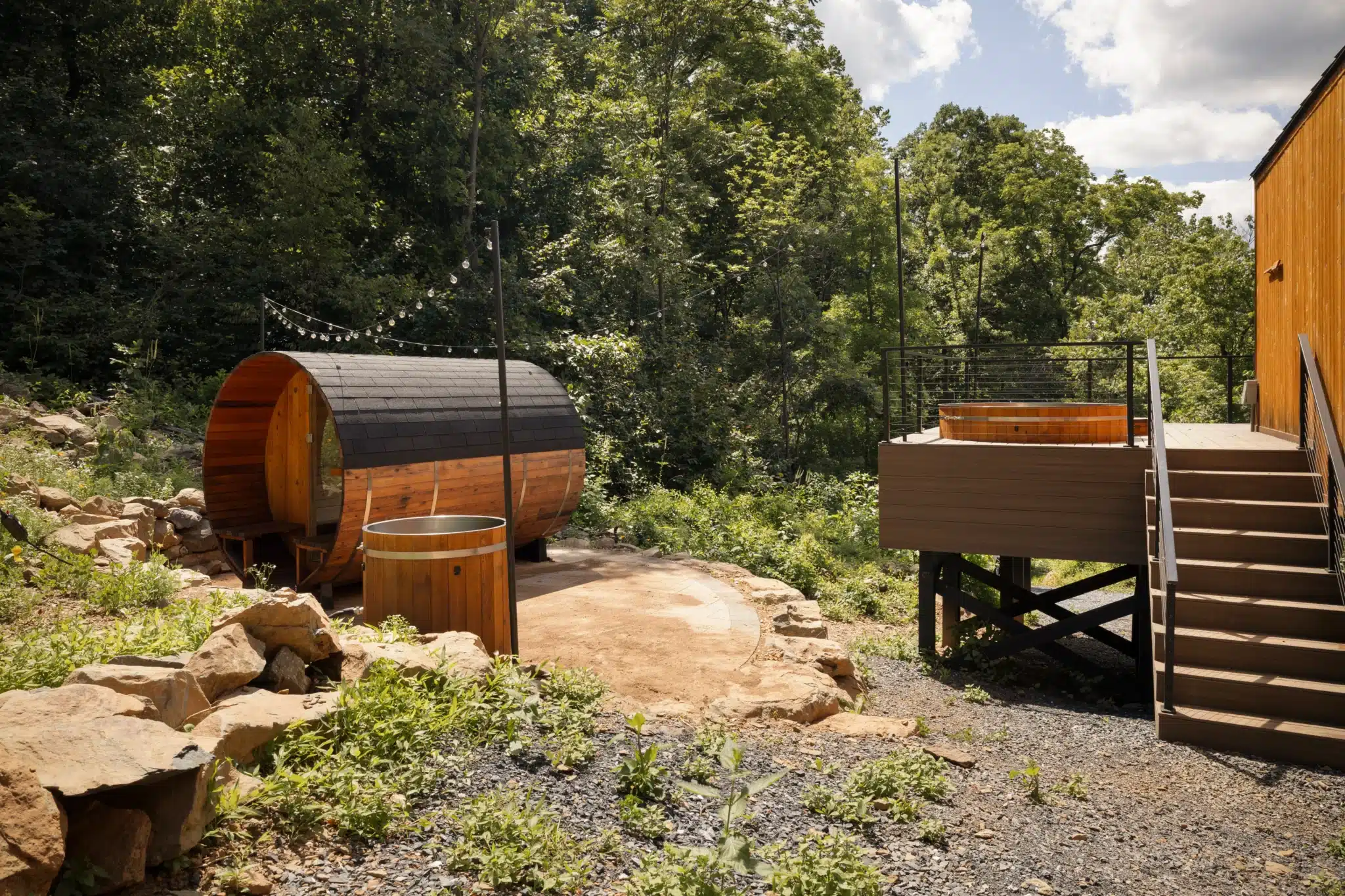
If your Skyline Drive plans start from the Front Royal side, Royal Oak Retreat sits about 40 minutes from the park boundary, close enough for an early start at Milepost 0 without a long drive back. The sunken hot tub and Scandinavian sauna make for a fitting way to close out a day spent on the ridge. Check availability and book direct here.
Content powered by inkSTR.co