
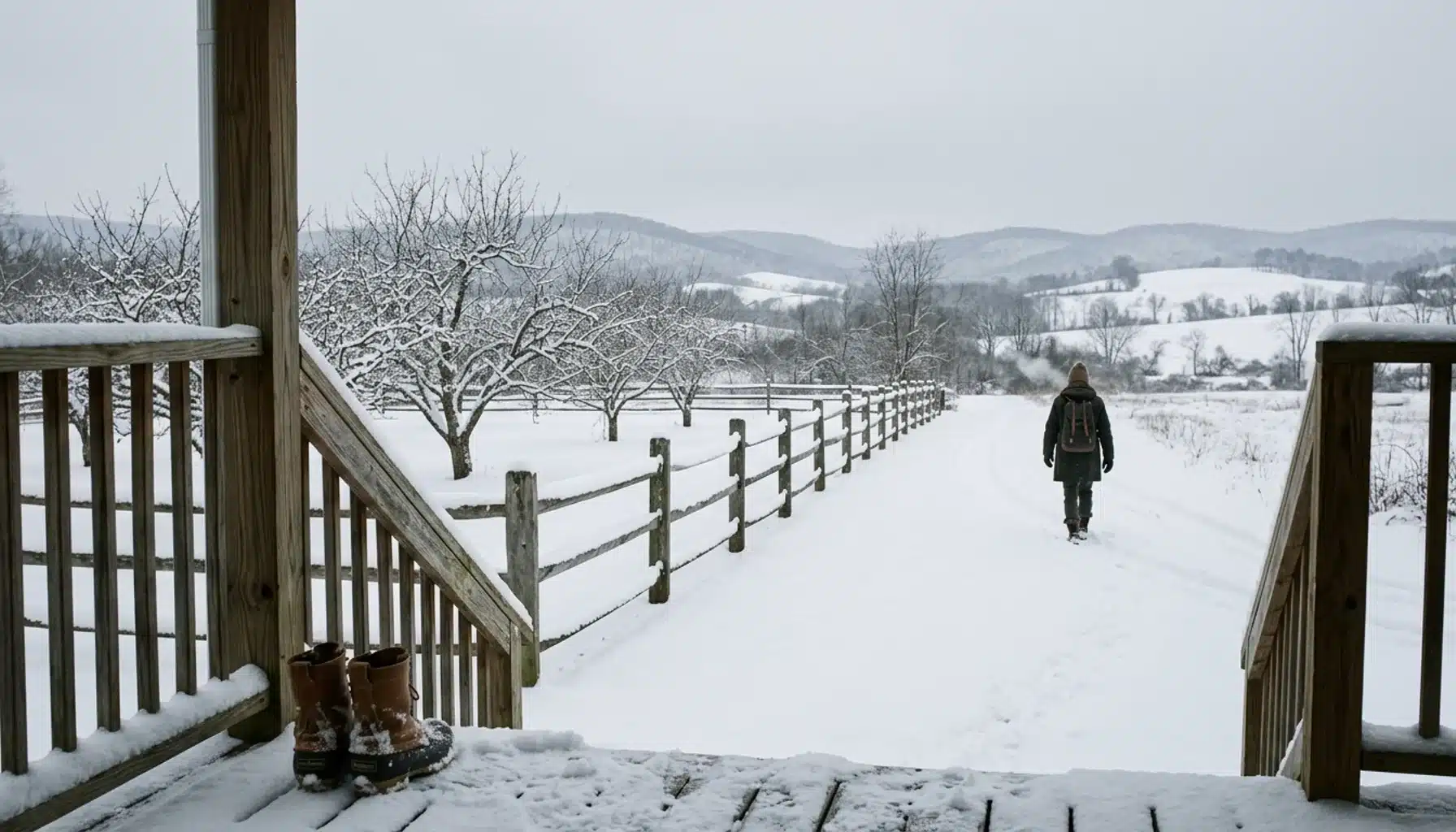
Virginia averages roughly 14 inches of snow per winter statewide, but that single number hides enormous regional swings. Coastal cities like Norfolk see about 6 inches a year, while high-elevation spots like Wise County in the far southwest average closer to 47 inches, and the Shenandoah Valley lands comfortably in between.
Key Takeaways
- Virginia’s statewide average annual snowfall is about 14 inches, though sources vary between roughly 13.8 and 15.3 inches depending on methodology.
- Snow season typically runs from November through March, with occasional flurries in October or April.
- Elevation matters more than latitude: Wise County (about 2,500 feet) averages around 47 to 52 inches a year, while sea-level Norfolk averages about 6.2 inches.
- Shenandoah Valley towns like Harrisonburg (19.4 inches) and Winchester (23.1 inches) sit well above the statewide average thanks to Blue Ridge and Allegheny elevation effects.
- Virginia’s 24-hour snowfall record is 33.5 inches, set at Luray on March 3, 1994; the deepest recorded snowpack was 47 inches at Big Meadows in January 1996.
- The Virginia Department of Transportation begins plowing priority roads once accumulation passes about 2 inches, though secondary roads and rural driveways clear far slower.
If you’re weighing a winter trip to the Shenandoah Valley in 2026 and wondering whether you’ll need snow boots or just a warm jacket, the honest answer is: it depends on where in Virginia you mean. A beach weekend in Virginia Beach and a cabin weekend near Front Royal are two different winters entirely, separated by less than 200 miles but by a factor of five or six in expected snowfall.
At Royal Oak Retreat, we’ve watched guests arrive from Washington D.C. expecting a light dusting and get a proper Shenandoah Valley snow instead, the kind that makes the sauna and hot tub feel like they were built specifically for that moment. This guide breaks down exactly how much snow to expect by region, what drives those differences, and how to plan a winter getaway around it rather than getting caught off guard.
We’ll cover the statewide average, the regional map from Tidewater to the Appalachians, city-by-city numbers, historical extremes, and the practical side of winter travel, including road conditions and what a 4×4 vehicle actually buys you on a snowy mountain driveway.
Does Virginia Get a Lot of Snow in Winter?
Virginia gets a moderate amount of snow overall, with a statewide average of about 14 inches per winter, but “a lot” depends entirely on which part of the state you’re asking about. Coastal Virginia rarely sees more than a few inches a year, while the Appalachian highlands in the southwest routinely top 40 inches.
Compiled climate data puts Virginia’s statewide range between 13.8 and 15.3 inches annually, a spread that reflects how different sources average their station data. That statewide figure is a blend of two extremes: barely-there coastal winters and genuinely snowy mountain winters. Specifically, if you only looked at Richmond or Norfolk, you’d assume Virginia barely gets snow at all. If you only looked at Wise County, you’d assume the opposite.
The Shenandoah Valley sits in the middle of that spread, and that’s exactly what makes it appealing for a winter cabin trip. As a result, you get real snow days, enough for a fire pit evening and a snow-dusted forest view through floor-to-ceiling windows, without the multi-foot accumulations that shut down mountain passes in the far southwest.
Does Virginia Have a Harsh Winter?
Virginia does not have a harsh winter by national standards. Winter temperatures typically range from about 29 to 49 degrees Fahrenheit statewide, and most of the state sees snow on fewer than 10 days per year, according to compiled climate normals.
Compare that to states farther north or at higher elevation nationally, and Virginia reads as mild. Richmond averages just 5.6 snow days a year. Norfolk averages 4.0. Even Winchester, in the northern Shenandoah Valley, averages only 10.4 snow days annually. That’s a winter defined more by cold, clear stretches than by repeated storms.
The exception is the Appalachian corridor in the west and southwest, where Burkes Garden averages 24.8 snow days a year and Wise County sees closer to 28.6. Notably, that’s still a fraction of what mountain states farther north experience, but it’s enough to require real winter driving habits: checking road conditions before heading out, keeping a full tank of gas, and, for anyone staying in the Shenandoah Farms area near Front Royal, having a vehicle that can handle a steep, occasionally icy driveway.

What City in Virginia Gets the Most Snow?
Wise County, in far southwest Virginia, gets the most snow of any populated area in the state, averaging between 37 and 52 inches per year depending on the data source. Sitting at roughly 2,500 feet elevation in the Appalachian Plateau, Wise sees more measurable snow days (around 28.6 annually) than anywhere else in Virginia.
Burkes Garden, a high mountain valley in Tazewell County sometimes called “Virginia’s Garden Spot,” runs a close second at 46.9 inches and 24.8 snow days a year. Both locations share the same driver: elevation. Specifically, cold air holds at higher altitude longer, and both towns sit in the path of Appalachian upslope snow, where moist air rides up the mountainside and dumps snow that lower-elevation towns nearby never see.
For context, the Shenandoah Valley doesn’t come close to Wise County’s totals, but it still outpaces most of the state. Winchester’s 23.1-inch average and Harrisonburg’s 19.4-inch average both beat the statewide 14-inch benchmark by a wide margin, which is part of why the valley reads as a genuine winter destination rather than a coastal town hoping for a rare dusting.
Is Virginia Considered a Cold State?
Virginia is not generally considered a cold state; it sits in a transitional climate zone between the humid subtropical Southeast and the more continental climate of the Mid-Atlantic interior. Winter lows in most of the state stay in the 20s and 30s Fahrenheit, with the coldest, snowiest conditions confined to higher elevations in the west.
Virginia’s climate splits cleanly along a west-to-east elevation gradient. The Atlantic coast and Tidewater region, including Virginia Beach and Norfolk, rarely dips into truly harsh territory; Virginia Beach averages only about 3.4 inches of snow a year based on 1991-2020 climate normals. Meanwhile the Blue Ridge and Allegheny highlands, including the Shenandoah Valley corridor, run consistently colder and snowier because of altitude, not latitude.
This is why two Virginia towns at nearly the same latitude can have wildly different winters. Richmond, in the central Piedmont, averages 8.8 inches of snow a year. Harrisonburg, roughly the same distance north-south but sitting in the Shenandoah Valley at higher elevation, averages more than double that. Elevation, not location on the map, decides how cold and snowy a Virginia winter actually feels.
How Does Snowfall Vary Across Virginia’s Regions?
Virginia’s snowfall breaks into four broad regional bands: the Atlantic coast and Tidewater, the central Piedmont, the Shenandoah Valley and Blue Ridge, and the far southwest Appalachian highlands. Each band sees a different winter almost entirely because of distance from the Atlantic Ocean and elevation above sea level.
The coast and Tidewater region, including Norfolk, Williamsburg, and Virginia Beach, stays warmed by ocean influence and rarely holds snow more than a day or two. Williamsburg averages just 4.3 inches and 1.6 snow days a year. Moving inland to the Piedmont, cities like Richmond (8.8 inches) and Lynchburg (11.6 inches) see modest increases as ocean warming fades and elevation climbs slightly.
Northern Virginia and the Shenandoah Valley form the next band, where elevation and proximity to the Blue Ridge start pulling numbers up meaningfully. Washington Dulles averages 21.0 inches per the 1991-2020 climate normals, and Winchester sits at 23.1 inches. Finally, the far southwest Appalachian highlands, anchored by Wise County and Burkes Garden, catch the most consistent upslope snow in the state, regularly exceeding 40 inches.
Regional Snowfall Comparison Table
| Region | Example City | Average Annual Snowfall | Average Snow Days |
|---|---|---|---|
| Atlantic Coast / Tidewater | Norfolk | 6.2 inches | 4.0 |
| Atlantic Coast / Tidewater | Virginia Beach | 3.4 inches | N/A |
| Central Piedmont | Richmond | 8.8 inches | 5.6 |
| Central Piedmont | Lynchburg | 11.6 inches | 5.7 |
| Northern VA / Shenandoah Valley | Washington Dulles | 21.0 inches | N/A |
| Northern VA / Shenandoah Valley | Winchester | 23.1 inches | 10.4 |
| Northern VA / Shenandoah Valley | Harrisonburg | 19.4 inches | 9.6 |
| Southwest Appalachian Highlands | Wise County | 47.1 to 52 inches | 28.6 |
| Southwest Appalachian Highlands | Burkes Garden | 46.9 inches | 24.8 |
Data compiled from Current Results climate tables, Town & Tourist regional reporting, and 1991-2020 station normals cited by Trip Traveling Guide.
What Are the Average Snowfall Totals for Major Virginia Cities?
Average snowfall in Virginia’s major cities ranges from about 3.4 inches in Virginia Beach to more than 23 inches in Winchester, with most mid-sized cities landing somewhere between 8 and 20 inches. The variation tracks closely with each city’s distance from the coast and its elevation above sea level.
Charlottesville, sitting at the eastern foot of the Blue Ridge, averages 17.0 inches and 7.6 snow days a year, a bit above the statewide average because of its proximity to the mountains. Roanoke averages 14.8 inches and 7.1 snow days, almost exactly matching the statewide figure. Arlington, closer to the coast but still inland enough to catch Nor’easters, averages 13.7 inches and 8.0 snow days.
On the low end, Danville averages just 4.6 inches and 2.0 snow days, and Suffolk sees 5.8 inches over 2.6 days. On the high end among mid-sized cities, Staunton in the Shenandoah Valley averages 21.6 inches across 8.7 snow days, reinforcing that valley towns consistently outperform the statewide average even without the extreme elevation of the far southwest.
What Drives the Differences in Virginia’s Snowfall Totals?
Three factors explain almost all of the variation in Virginia’s snowfall: elevation, distance from the Atlantic Ocean, and storm track. Higher elevation areas stay colder longer and catch upslope precipitation, coastal areas get warmed by ocean influence, and the specific path a winter storm takes determines which regions get buried and which get bypassed entirely.
Elevation is the strongest driver. Wise County sits around 2,500 feet, and that altitude alone pushes its average from a coastal-style 6 inches to nearly 50. The same air mass that drops light rain in Norfolk can drop heavy snow in the mountains simply because temperatures at altitude stay below freezing longer during a storm’s approach.
Distance from the Atlantic matters almost as much. Ocean water retains heat, and that warmth radiates inland, which is why Virginia Beach and Norfolk rarely see accumulating snow even during storms that dump a foot in the Shenandoah Valley just 150 miles west. Storm track adds the final layer of unpredictability: a storm sliding up the coast (a classic Nor’easter) can bury Tidewater while missing the valley, while a storm crossing from the Ohio Valley does the opposite, dragging cold air and upslope snow into the mountains while the coast stays dry.
What Snowfall Records Has Virginia Set?
Virginia’s record for snowfall in a single 24-hour period is 33.5 inches, set at Luray in Page County on March 3, 1994. The state’s deepest recorded snowpack, 47 inches, was measured at Big Meadows in Madison County during the January 1996 blizzard, an event that dropped more than four feet of snow across much of the state.
Both records come from the same general geography: the Blue Ridge and Shenandoah Valley corridor, where elevation amplifies whatever a storm is already delivering. The January 1996 blizzard is still the benchmark storm that longtime Virginia residents reference when comparing modern winters, an event severe enough that Town & Tourist and other regional sources continue to cite it as the state’s defining winter weather moment three decades later.
These records matter for practical reasons too. If you’re staying near Luray or Big Meadows on Skyline Drive in a heavy winter, know that the terrain has historically supported extreme accumulation. It’s rare, but it isn’t impossible, and it’s part of why anyone renting a cabin in this corridor during December through February should plan for the possibility of a real snow event, not just a light dusting.
How Does Elevation Change What You Should Expect on a Winter Trip?
Elevation changes winter driving conditions faster than most travelers expect, sometimes within a 20-minute drive. A trip that starts on clear, dry pavement near Front Royal can end on a snow-packed forest road just a few hundred feet higher, particularly along Skyline Drive and the private roads feeding into Shenandoah Farms.
This is the single most common surprise for D.C.-area travelers heading to a Shenandoah Valley cabin for the first time. The forecast for Washington D.C. might show light rain, while the same storm system, thirty minutes further west and a few hundred feet higher, drops several inches of snow. Skyline Drive itself, which runs the length of Shenandoah National Park, closes sections during heavy snow and ice, so checking current conditions before a winter drive is not optional.
For that reason, we specify to every guest booking Royal Oak Retreat during winter months that a 4×4 vehicle is required, not suggested, because the steep driveway into Shenandoah Farms can hold snow and ice well after the main roads have cleared. It’s an honest trade-off: the same elevation that makes the drive occasionally tricky is what gives the cabin’s floor-to-ceiling windows a genuine snow-forest view that lower-elevation rentals simply can’t offer.

How Should You Plan Winter Travel and Driving in Snowy Virginia Conditions?
Planning winter travel in Virginia means checking road conditions before departure, allowing extra drive time, and confirming your vehicle can handle secondary roads that clear more slowly than interstates. The Virginia Department of Transportation prioritizes interstates and primary roads first, then secondary and neighborhood roads, which means a rural cabin access road might not see a plow for hours after a storm passes.
Fairfax County’s own snow-management guidance notes that road crews typically begin active plowing once accumulation passes about 2 inches, across more than 14,000 lane miles in that county alone. Extrapolate that same prioritization statewide, and it becomes clear why secondary roads near Shenandoah Farms, Linden, or Front Royal can stay snow-covered well after Interstate 66 is clear.
Before any winter drive in this region, check 511 Virginia for real-time road conditions and closures, and review VDOT’s winter weather guidance on vehicle preparation. For forecast specifics closer to your travel date, the National Weather Service remains the most reliable source, since averages and historical records won’t tell you what a specific storm is going to do next week.
Practical Steps for a Winter Shenandoah Valley Trip
- Check the National Weather Service forecast 3 to 5 days out, and again the morning of travel.
- Confirm your vehicle is 4×4 or all-wheel drive if you’re staying anywhere with a steep or rural access road.
- Pack an emergency kit: blanket, flashlight, ice scraper, and a full tank of gas before heading into mountain terrain.
- Check 511 Virginia for Skyline Drive and Interstate 66 conditions before departure.
- Build in an extra 30 to 60 minutes of drive time for the final stretch of rural or private roads.
- If snow is actively falling, delay non-essential driving until secondary roads have been plowed at least once.
Common Mistakes Travelers Make Planning a Virginia Winter Trip
The most common mistake is assuming a Washington D.C. forecast applies to the Shenandoah Valley or Blue Ridge. Snowfall can differ by several inches over a 60-minute drive because of elevation, so checking the forecast for your actual destination, not your departure city, matters more in Virginia winters than in flatter states.
A second mistake: underestimating how quickly a steep driveway freezes overnight even when the road itself is clear. Front-wheel-drive sedans regularly get stuck on private mountain access roads that look perfectly manageable during the day but ice over once temperatures drop after sunset. A third mistake is packing for the coast (light layers, sneakers) instead of the mountains (insulated boots, real winter layers) simply because “Virginia” doesn’t sound like a snowy state on paper.
Finally, many travelers skip checking whether an attraction or trail is even open in winter. Sections of Skyline Drive close during ice events, and some overlooks and visitor facilities reduce hours seasonally. Confirming current status through the official Shenandoah National Park activity page before finalizing a day trip saves a wasted drive.
Is a Winter Getaway to the Shenandoah Valley Worth It?
A winter trip to the Shenandoah Valley is worth it for travelers who want genuine seasonal contrast: cold air, occasional real snow, and quiet trails, without the extreme accumulation of the Appalachian far southwest. The valley’s 19 to 23 inch average snowfall range gives you enough winter atmosphere to justify a hot tub and sauna without the driving risk of a 40-plus-inch mountain winter.
January and February bring the valley’s quietest stretch, both on the roads and at overlooks that get crowded during fall foliage season. It’s also, frankly, the best time to book a wellness-focused stay: fewer people on the trails, cold enough to make contrast therapy feel purposeful rather than performative, and long, dark evenings built for a fire pit under a genuinely clear Virginia sky.
If you’re deciding between a hotel in town or a private cabin, the private cabin wins for a winter trip specifically because you’re not managing shared spaces during unpredictable weather. Our guide on the best cabin rentals in Shenandoah Valley Virginia covers what separates a genuine winter-ready cabin from one that’s only comfortable in summer.
Frequently Asked Questions
Does it snow a lot in the Shenandoah Valley in winter?
The Shenandoah Valley sees a moderate amount of snow, with towns like Harrisonburg averaging 19.4 inches and Winchester averaging 23.1 inches per year, both well above Virginia’s statewide 14-inch average. Snow typically falls between November and March, with occasional flurries outside that window.
When does fall start in Virginia?
Fall in Virginia typically begins in late September, though peak foliage in the Shenandoah Valley and Blue Ridge Mountains usually arrives in mid to late October, roughly a month before the winter snow season begins in earnest.
How long does it take to drive Skyline Drive?
Skyline Drive runs 105 miles through Shenandoah National Park, and driving the full length typically takes about 3 hours without stops, given the 35 mph speed limit throughout. In winter, add extra time for reduced visibility, ice, and potential temporary closures on higher sections.
Where does Skyline Drive start and end?
Skyline Drive starts at Front Royal in the north, near the park’s northern entrance, and ends at Rockfish Gap near Waynesboro in the south, where it connects to the Blue Ridge Parkway. The northern entrance near Front Royal sits closest to the Shenandoah Farms area.
Which Virginia luxury stay is best if I want both privacy and enough activities to justify the nightly rate?
A private wellness cabin in the Shenandoah Farms or Front Royal area gives you both: seclusion for the stay itself, plus proximity to Skyline Drive, Luray Caverns, and multiple wineries within a 5 to 10 minute drive. Royal Oak Retreat pairs a sunken hot tub, sauna, and cold plunge with that exact location advantage, roughly 40 minutes from the national park and an hour from Washington D.C.
Where should I stay for a romantic proposal weekend in Virginia horse country?
The Virginia Piedmont, home to horse country counties like Fauquier and Rappahannock, sits adjacent to the Shenandoah Valley and pairs well with a private cabin stay for a proposal weekend. Check Virginia Piedmont lodging listings for horse-country-specific stays, or base yourself at a Shenandoah Valley cabin like Royal Oak Retreat and day-trip into the Piedmont for wineries and scenery.
What city in Virginia gets the most snow each winter?
Wise County in far southwest Virginia gets the most snow of any populated area, averaging between 47 and 52 inches annually depending on the data source, largely because of its roughly 2,500-foot elevation in the Appalachian Plateau.
Is it safe to drive to a Shenandoah Valley cabin during winter?
Driving to a Shenandoah Valley cabin during winter is generally safe if you check road conditions beforehand and use a vehicle suited to the terrain. Rural access roads, including the driveway into Shenandoah Farms, often require a 4×4 vehicle even after main roads have been cleared, since VDOT prioritizes interstates and primary roads first.
Conclusion: Planning Around Virginia’s Real Winter Weather
Virginia’s statewide average of about 14 inches of snow tells you almost nothing about what to actually expect on any given trip, because the real story is regional. Coastal towns barely see snow, the Shenandoah Valley gets a genuine but manageable winter around 19 to 23 inches, and the far southwest highlands can top 47 inches in a typical year.
For a 2026 winter getaway, that middle ground is exactly the appeal. You get real snow days, cold enough nights to make a sauna and hot tub feel earned, and none of the extreme accumulation risk of the deep Appalachians. Check current forecasts through the National Weather Service before you travel, confirm your route on 511 Virginia, and pack for mountain cold rather than D.C. mild.
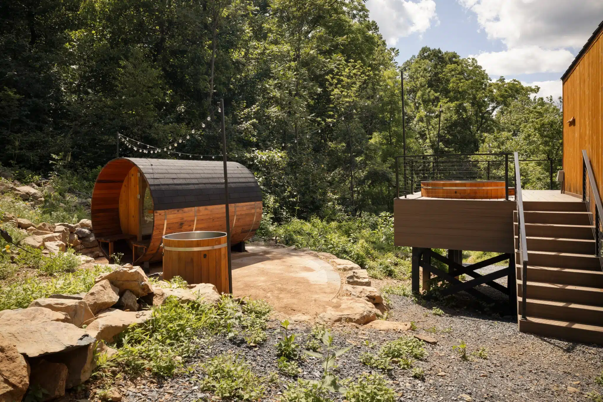
If a snow-quiet winter trip sounds better than a crowded summer weekend, Royal Oak Retreat puts you 40 minutes from Skyline Drive with a sunken hot tub and Scandinavian sauna waiting on the deck, exactly the kind of setup that makes a cold Shenandoah night worth driving for. Book direct through the official listing to confirm winter availability and current conditions before your trip.
Content powered by inkSTR.co