
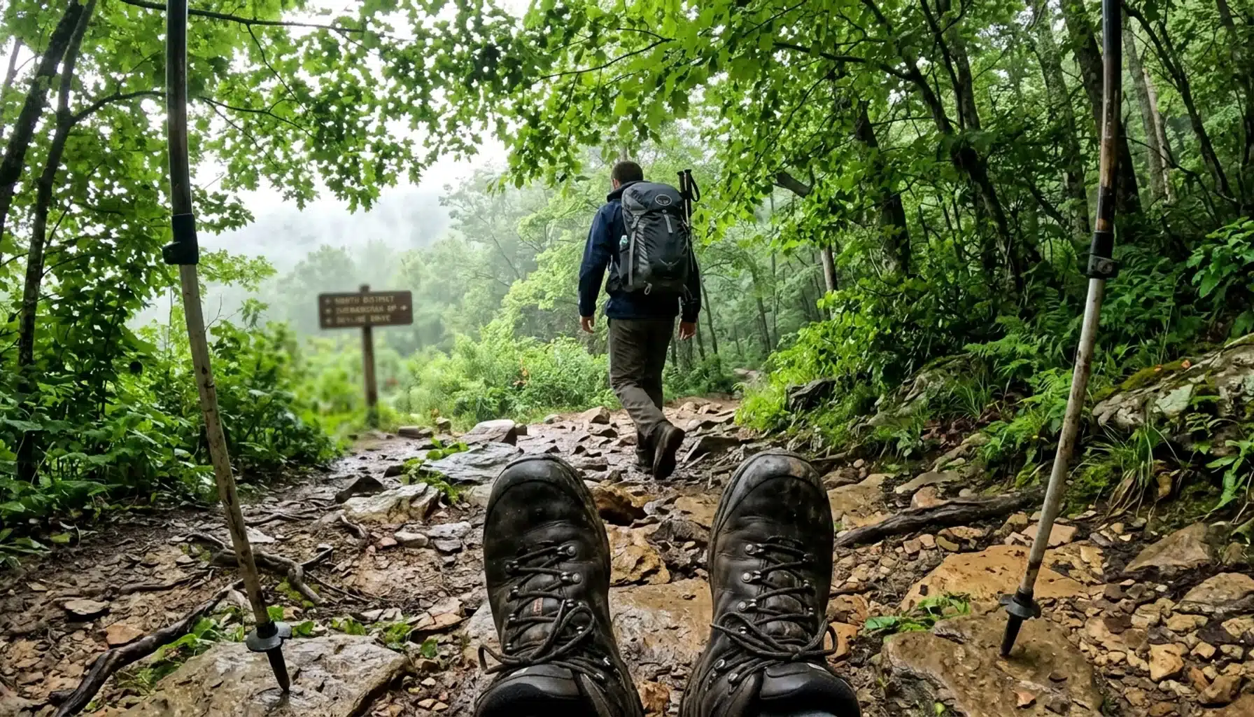
Searching for a hiking trail near me in the Shenandoah Valley usually means you are within striking distance of Skyline Drive, and the honest answer is that you have more than 500 miles of trails inside Shenandoah National Park alone, according to the National Park Service. The trick is not finding a trail. It is finding the right one for your fitness level, your timeline, and how many other cars will be at the trailhead.
Key Takeaways
- Shenandoah National Park has more than 500 miles of hiking trails, per the National Park Service, ranging from half-mile overlooks to multi-day Appalachian Trail sections.
- The park drew 1.7 million visitors in 2026, and those visitors spent an estimated $132 million in nearby communities, according to NPS Visitor Spending Effects data.
- Front Royal’s northern Skyline Drive entrance sits roughly 40 minutes from Shenandoah Farms, making it the fastest way into the park’s trail system from a Front Royal, Virginia base.
- A standardized checklist covering distance, elevation gain, parking, cell service, and water access helps you compare trails before you drive out, instead of guessing at the trailhead.
- Weekend crowding is real: popular routes like Old Rag and Dark Hollow Falls fill their lots by mid-morning on Saturdays, especially during October’s peak foliage window.
- A 2026 America the Beautiful annual pass or a Shenandoah 7-day vehicle pass, both purchased through Recreation.gov or the USGS store, gets you through the entrance gate without a cash-only line delay.
If you are typing “hiking trail near me” into your phone while parked in Front Royal or planning a weekend escape from the DMV area, you are almost certainly within an hour of one of the mid-Atlantic’s densest trail networks. Shenandoah National Park’s northern district starts right at the edge of town, and Skyline Drive runs the length of the Blue Ridge for 105 miles south from there.
This guide breaks down how to actually find the right trail for your day, not just the most-photographed one. We will cover how to filter by difficulty and distance, which trailheads get overrun and when, what to check before you leave the driveway, and where a 4×4 vehicle or an early start actually matters. We will also flag the planning details most trail guides skip entirely: parking fee logistics, cell coverage gaps, and how to cross-check crowdsourced trail data against the park’s own condition reports.
At Royal Oak Retreat, we sit inside Shenandoah Farms, close enough to the park’s northern entrance that guests routinely hike a morning trail and soak in the sunken hot tub by early afternoon. That proximity shapes a lot of what follows, because the trails you can realistically reach before the parking lots fill up are different depending on where you are staying.
How Do You Actually Find a Hiking Trail Near You in Shenandoah Valley?
Finding a hiking trail near you in the Shenandoah Valley means combining a location-based search tool with a filter for your specific constraints: distance, difficulty, and time available. The fastest method is opening AllTrails or onX, entering “Shenandoah National Park” or a specific town like Front Royal, and filtering by radius.
Specifically, AllTrails lets registered users set a distance-away radius between 5 and 60 miles, per its own trail search support documentation. That radius filter is more useful than scrolling a generic map, because it converts “near me” into an actual number you control.
For Shenandoah specifically, skip the generic app search first and start with the source: the official NPS Things to Do page for Shenandoah National Park lists trails by district (North, Central, South) along Skyline Drive’s milepost system. Every overlook and trailhead has a milepost number, so once you know your entry point, you can scan nearby mileposts instead of guessing.
If you are entering from Front Royal, you are in the North District, home to Compton Peak, Compton Gap, and the northern end of Skyline Drive. Guests staying in Shenandoah Farms are roughly 40 minutes from this entrance, which puts a dozen North District trailheads within a single tank of gas and no highway driving.
What Filters Actually Matter When Comparing Trails Near You?
The filters that matter most when comparing nearby trails are difficulty rating, round-trip mileage, elevation gain, and trail traffic level, since these four factors predict both how hard a hike will feel and how crowded it will be. AllTrails supports all four, plus surface type and route shape (loop, out-and-back, or point-to-point), according to its filter documentation.
Elevation gain is the filter most casual hikers ignore, and it is the one that ruins afternoons. A 3-mile hike with 1,800 feet of gain is a completely different day than a 3-mile hike with 200 feet of gain, even though the mileage looks identical on a trail card.
Additionally, check trail traffic ratings before a weekend trip. AllTrails classifies traffic as light, moderate, or heavy, and heavy-traffic trails near Shenandoah, like Old Rag, routinely fill their dedicated parking area by 8 or 9 a.m. on fall Saturdays.
For readers hiking with a dog, AllTrails and onX both filter for dog-friendly routes, but Shenandoah National Park requires leashes no longer than six feet on every trail in the park, per NPS regulations, so “dog-friendly” here means leashed, not off-leash.
A Practical Comparison Framework
Instead of clicking between five different trail cards, use one table to compare your shortlist side by side. This is the single biggest gap in most trail-finding content: nobody puts distance, elevation, surface, and logistics into one place before you commit to a drive.
| Trail | Distance (RT) | Difficulty | Elevation Gain | Notable Feature |
|---|---|---|---|---|
| Dark Hollow Falls | 1.4 miles | Moderate | Approx. 440 ft | Waterfall, heavy weekend traffic |
| Blackrock Summit | 1 mile | Easy | 175 ft | Talus-field summit views, milepost 84.4 |
| Bearfence Rock Scramble | Approx. 1 mile loop | Moderate (scramble) | Short, steep bursts | 360-degree summit, hands-on scramble |
| Upper Hawksbill Summit | Approx. 2.1 miles | Moderate | Approx. 520 ft | Highest point in the park |
Notice what this table does not include: trails we have not verified specific mileage or elevation for. That is intentional. If a trail card online gives you a number that seems off, cross-check it against the official NPS trail page before you plan a day around it.

What Should You Verify Before You Drive to a Trailhead?
Verifying trail conditions before you drive means checking three things: current closures, parking fee requirements, and cell service expectations, because crowdsourced apps often lag behind official park updates. The Illinois Department of Natural Resources advises stopping at a visitor center or park office before hiking specifically to confirm current conditions, and the same logic applies in Shenandoah.
First, check the park’s official closure list. Storm damage, bear activity, or trail maintenance can close a route that still shows as “open” on a crowdsourced app that has not synced recent reports.
Second, confirm your entrance fee method in advance. As of 2026, you can buy a Shenandoah 7-day vehicle pass online through Recreation.gov for $30, which lets you skip the cash line at the gate entirely. If you plan to visit multiple national parks this year, the America the Beautiful annual pass, sold through the USGS store for $80, pays for itself after roughly three visits.
Third, expect gaps in cell coverage almost everywhere on Skyline Drive except near visitor centers. Download offline maps before you leave, and tell someone your planned route and return time, especially for longer hikes on the Appalachian Trail sections that cross through the park.
Stop at the Dickey Ridge Visitor Center near the North District entrance if you are coming from Front Royal. Rangers there post same-day trail condition updates that no app captures in real time, and it is the fastest way to confirm whether a specific overlook parking area is already full.
How Difficult Is Old Rag Compared to Shorter Shenandoah Trails?
Old Rag is one of the most physically demanding day hikes in Shenandoah National Park, involving roughly 9 miles round trip with a rock scramble section that requires using your hands, compared to the 1 to 2 mile easy or moderate loops found elsewhere in the park. If your search for a hiking trail near you turned up Old Rag first, know what you are actually signing up for.
The scramble section near the summit is not optional; it is the defining feature of the hike, and it is genuinely uncomfortable for anyone with a fear of heights or limited upper-body mobility. Plan for four to seven hours total, depending on your pace and how long you linger at the summit views.
Old Rag has a well-earned reputation as one of the park’s most popular hikes, and it deserves that reputation for the payoff at the top. But the parking area fills early, often before 8 a.m. on autumn weekends, and rangers have in past seasons implemented a day-use ticket system during peak season, so verify current entry requirements on the official NPS site before you go.
If Old Rag’s crowds or scramble sound like more than you want, Bearfence Rock Scramble offers a shorter, less committing version of the same hands-on summit experience, at roughly a tenth of the distance. It is a strong substitute for hikers who want exposure and a view without dedicating a full day.
How Do You Plan a Half-Day Hike from a Shenandoah Farms Base Camp?
Planning a half-day hike from Shenandoah Farms starts with picking a North District trail within a 40-minute drive, since that keeps your total time commitment, including drive time and the hike itself, under four hours. This matters if you are traveling from the DMV area and only have a Saturday to work with.
For example, a guest staying in Shenandoah Farms can reach Skyline Drive’s northern entrance near Front Royal in about 40 minutes, according to property location data. From there, Compton Peak and several shorter North District overlooks sit within another 10 to 20 minutes of driving along the parkway.
A realistic half-day plan looks like this: leave your cabin by 8 a.m., arrive at the trailhead by 9 a.m. before the lot fills, hike for two to three hours, and be back at your car by early afternoon. That timeline leaves the rest of the day for the contrast-therapy island back at the cabin, alternating a Scandinavian sauna session with a soak in the sunken hot tub.
If you would rather build a full trip around the park instead of a single hike, our complete guide to Shenandoah National Park hiking trails breaks down routes by district and season. And if you want a broader look at what fills the rest of a weekend, the seasonal guide to things to do in Shenandoah Valley covers wineries, caverns, and river outfitters within a similar drive radius.

What Do Most Trail-Finding Guides Get Wrong?
Most trail-finding guides treat hiking as a single undifferentiated activity, when in practice a family with young kids, a dog owner, and a serious distance hiker need three completely different search strategies. Generic “near me” tools rarely separate these use cases clearly.
Specifically, a stroller-friendly, paved route and a strenuous Appalachian Trail section both technically qualify as “hiking trails near Front Royal,” but they serve completely different searchers. If you filter only by distance and difficulty without also filtering by surface type and route shape, you will end up comparing routes that are not actually comparable.
Another common gap: most guides list a trail’s mileage and difficulty rating but skip parking capacity, restroom availability, and whether the trailhead has reliable cell service. These details determine whether your trip day goes smoothly, and they rarely make it into a trail card.
As a result, we recommend cross-referencing any crowdsourced trail listing against the official Blue Ridge Parkway hiking page or Shenandoah’s own trail pages before finalizing a plan, particularly for anything longer than 3 miles or involving a stream crossing. Official sources post active closures that apps sometimes miss for days.
What Should You Pack for a Blue Ridge Trail Day?
Packing correctly for a Blue Ridge trail day means preparing for temperature swings of 10 to 15 degrees between the valley floor and Skyline Drive’s higher elevations, since Shenandoah’s ridgeline can run noticeably cooler and windier than Front Royal at the same hour. This catches first-time visitors off guard more than any other planning detail.
Bring layers even in summer. Morning starts at higher overlooks can feel 10 degrees cooler than the trailhead parking lot, and afternoon thunderstorms build quickly over the ridge from late spring through early fall.
Carry more water than you think you need. Many North District trails have no potable water source along the route, and the exertion from elevation gain dehydrates hikers faster than flat terrain does.
For fall visits, plan around peak foliage, which typically arrives on the higher elevations of Skyline Drive before it reaches the valley floor, sometimes by a week or two. That timing gap is worth knowing if you want color without the absolute peak-weekend crowds.
If you want a physical trail map instead of relying entirely on your phone, in areas with no cell service, the Shenandoah National Park Association sells park-specific hiking books and maps, and it is a reliable backup for anyone hiking beyond the short overlook trails.
Is Hiking in Shenandoah Safe for Everyone? What Should You Know Before You Go?
Elevation and Exertion: Shenandoah’s ridgeline trails climb to elevations over 4,000 feet at points like Hawksbill, and the exertion combined with thinner air can catch out-of-shape hikers off guard. If you have a heart condition or are not used to sustained uphill walking, start with an easy, short route like Blackrock Summit and build up from there.
Weather and Lightning: Afternoon thunderstorms are common over the Blue Ridge from late spring through summer, and exposed ridgeline sections offer no shelter. Check the forecast before you leave and start early to be off exposed summits by early afternoon.
Footing and Rock Scrambles: Trails like Old Rag and Bearfence involve genuine rock scrambling, not just uneven dirt paths. Anyone with knee problems, balance issues, or a fear of heights should choose a rated “easy” or “moderate” trail without a scramble section instead.
Wildlife Awareness: Black bears are present throughout the park, and encounters, while uncommon, do happen on quieter trails. Make noise while hiking, store food properly, and keep dogs leashed, since Shenandoah requires leashes no longer than six feet on every trail.
Cell Service Gaps: Large sections of Skyline Drive and its trails have no reliable cell signal. Tell someone your hiking plan and expected return time before you start, particularly for anything longer than a two-hour loop.
How Do You Choose the Right Trail for Your Group?
Choosing the right trail for your group means matching the hardest constraint in your party, whether that is a child’s stamina, a dog’s leash requirement, or a hiker’s fear of heights, to the trail’s difficulty rating rather than picking based on scenery alone. Skipping this step is the most common planning mistake.
- Identify your group’s limiting factor first: youngest hiker’s endurance, any mobility issues, or a dog that needs frequent water breaks.
- Filter for trails rated “easy” or “moderate” if anyone in the group is new to hiking or unsure of their fitness level.
- Check elevation gain, not just mileage. A short trail with steep gain can be harder than a longer flat one.
- Confirm parking capacity and arrive before 9 a.m. on weekends for any trail rated “heavy” traffic.
- Bring a paper map backup for any route beyond a mile or two, since cell service is unreliable across most of the park.
- Check the current entrance fee method, since Recreation.gov passes save time at the gate compared to paying cash.
A common mistake worth naming directly: choosing a trail based purely on Instagram photos of the summit view, without checking the mileage or scramble difficulty required to get there. Old Rag’s summit views are genuinely worth the effort, but plenty of hikers underestimate the approach and end up exhausted well before the top.
Frequently Asked Questions
What is the closest hiking trail to Front Royal, Virginia?
The closest trails to Front Royal sit inside Shenandoah National Park’s North District, accessible through the park’s northern Skyline Drive entrance. Compton Peak and several short overlook trails near the northern mileposts are typically within a 40 to 50 minute drive of most Front Royal lodging.
Do I need a permit to hike in Shenandoah National Park?
Day hiking does not require a separate permit, but every vehicle needs an entrance pass, either a 7-day pass purchased through Recreation.gov or an annual America the Beautiful pass from the USGS store. Overnight backcountry camping requires a free backcountry permit, available at park visitor centers.
Are dogs allowed on Shenandoah hiking trails?
Dogs are allowed on most Shenandoah trails as long as they stay on a leash no longer than six feet, per park regulations. A small number of trails restrict dogs entirely, so check the specific trail page before bringing a pet along.
What is the best time of year to hike near Shenandoah National Park?
Fall, particularly mid to late October, brings the most demand due to foliage, while spring offers wildflowers with noticeably lighter crowds. Summer weekends see heavy traffic on popular trails, and winter hiking requires checking for ice and snow closures, along with a 4×4 vehicle if you are staying somewhere with a steep driveway.
How crowded does Old Rag get on weekends?
Old Rag’s dedicated parking area routinely fills by 8 or 9 a.m. on fall weekends, and the park has in past seasons used a day-use ticket system during peak months. Arriving before sunrise or choosing a weekday significantly improves your odds of an available parking spot.
Is Royal Oak Retreat close enough to hike and still relax the same day?
Yes. Royal Oak Retreat sits in Shenandoah Farms, roughly 40 minutes from Shenandoah National Park’s Skyline Drive entrance, close enough for a morning hike followed by an afternoon soak in the sunken hot tub or a Scandinavian sauna session back at the cabin.
Can I bring my dog on a Shenandoah hiking trip and still stay somewhere upscale?
Yes. Royal Oak Retreat welcomes one dog under 50 lbs with a pet fee, inside a fully non-toxic, chemical-free cabin build, so a hiking trip with your dog does not mean compromising on the quality of where you stay.
Conclusion
A hiking trail near you in the Shenandoah Valley is rarely more than an hour away, and the real work is matching the right route, whether that is a one-mile summit scramble at Blackrock or the full nine-mile commitment of Old Rag, to your group’s fitness and timeline. Use the official NPS trail pages to verify conditions, not just crowdsourced apps, and always check parking capacity before a weekend drive.
As of 2026, the park’s more than 500 miles of trails and its northern Skyline Drive entrance near Front Royal remain the most direct way for DMV-area travelers to reach real Blue Ridge terrain without a full-day drive. Whether you come for a single afternoon hike or build a full weekend around it, the planning details in this guide, from parking fees to cell coverage gaps, should save you a wasted trip.
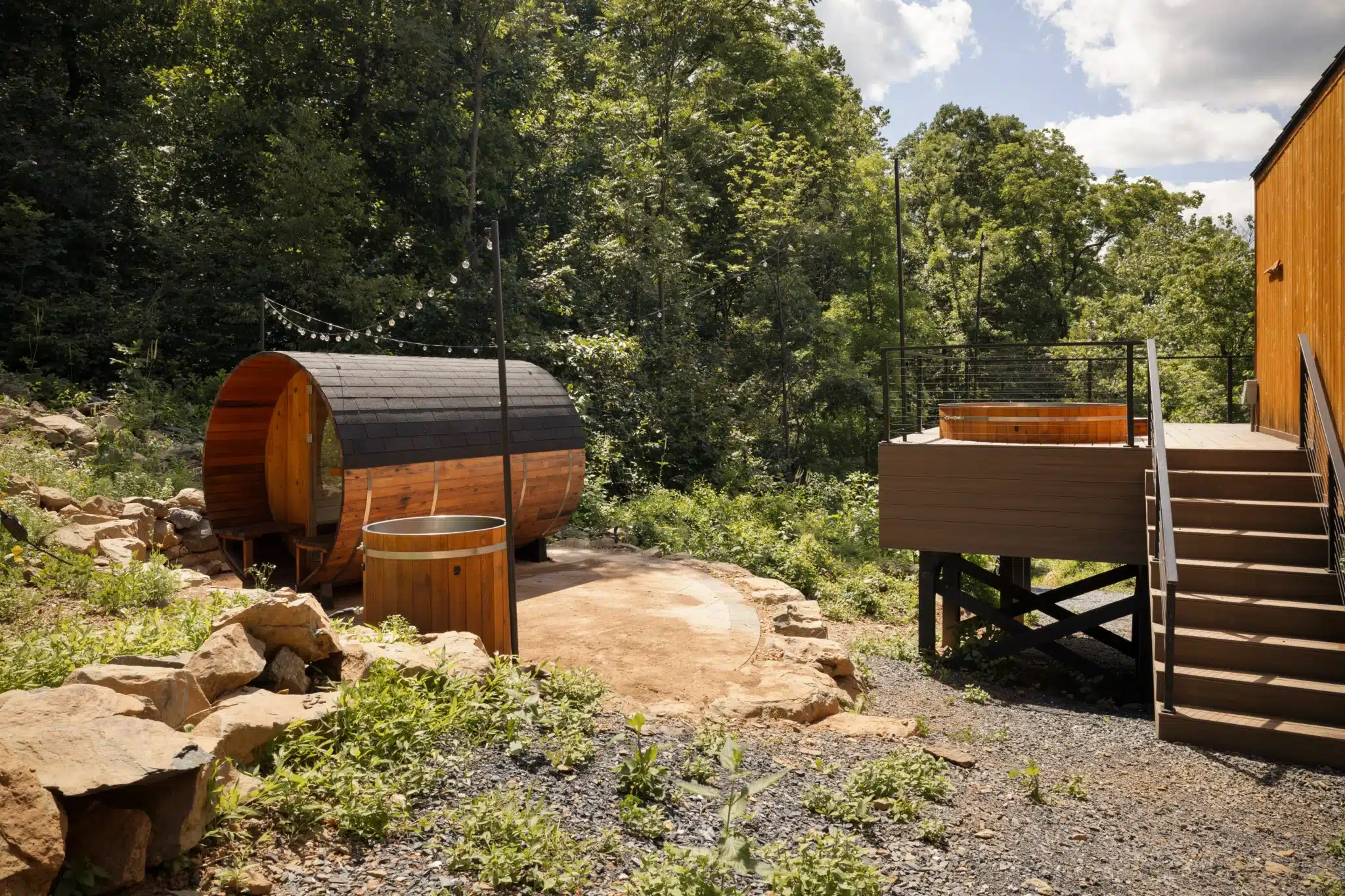
After a morning on the trail, Royal Oak Retreat puts you about 40 minutes from Shenandoah’s northern trailheads and gives you a real reason to head back before dark: a dedicated contrast-therapy island with a sauna, cold plunge, and sunken stargazing hot tub. Check current availability here.
Content powered by inkSTR.co